
The Digital India initiative by the Government aims at reforming Government through technology and provides Electronic Delivery of Services (EDS). Digital India will transform India into a digitally empowered society and knowledge economy. It will transform the entire ecosystem of public services through the use of information technology.
Digital India is centered on three key areas:
- Digital Infrastructure as a utility to every citizen
- Governance and services on demand
- Digital empowerment of citizens

Geo-enabling Digital India -:
Geographic Information Systems are becoming a catalyst for several transformational changes in the world; primarily in natural resource management, planning, decision-making, governance and citizen engagement. The location is an important parameter in virtually every aspect of the functioning of the government and hence GIS would always be a critical component of most of the mission mode projects conceptualized and implemented by the government. While e-governance is the current paradigm, the future lies in embedding GIS in governance and service delivery. GIS forms an important component of the Digital India project and should be leveraged for decision support systems and development.
Key Attributes of National GIS -:
The mission of National GIS should be to embed GIS into various electronic services extended to citizens under the Digital India project. It should provide a platform to enable consumption of spatial data by various e-governance applications thereby bringing in geographic dimension in decision making and service delivery. It should also provide a decision support system which will integrate geospatial content into various business processes of the government.
Geospatial technology facilitates the capture of such detailed data from a broad range of inputs; present data in a user-friendly, intuitive map formats; presents an opportunity to dynamically maintain data in real time; and allows individuals to input additional information, creating a platform for innovation. Geographic Information Systems (GIS) applications are enabling analytical capability through feature-based modeling of environments. Location/geospatial data have a range of applications across sectors but hold particular promise to help achieve government’s ambitions around smart cities.

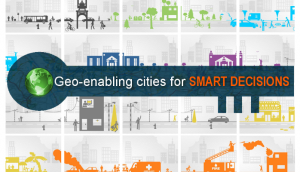
Geo-Smart City-:
Indian cities are complex with residential and commercial spaces supported by foundational infrastructures like power, water, roads, sewage, schools, religious bodies, and hospitals. Departments managing these facilities and urban governance bodies have been generating huge amounts of citizen data over the decades. However, this data is not in a state of right fit to provide the necessary critical insights to support decision making and planning. Geo-enabling this data gives that connect and makes one understand what is where so that cities can measure and monitor every aspect effectively.
Geospatial data across smart city life cycle: –
Geospatial data is a great enabler across the smart city subsystems right from the way energy efficiency is monitored, to transportation planning, effective land management, public health monitoring, safety and security management However, for all the subsystems to work seamlessly as an integral family, a centralized information system based on GIS is required to integrate every stakeholder across a smart city. Such a centralized platform enables urban agencies put the data into perspective, visualize, analyze and extract actionable information and intelligence to respond to situations. This ability uniquely places geospatial data as a unifying component of a smart city enterprise.
In conclusion, National GIS will be a critical component of the transformational Digital India project. By geo-enabling the e-governance projects. it will embed geographic dimension into various services being delivered by the government to the citizens. It will also introduce location as an important parameter in the decision making process thereby making it more comprehensive and holistic. It will be a system of systems which will consolidate the work already done by the states and central government in establishing GIS at ministry and departmental level and align it to the larger goal of transforming India into digitally empowered society and knowledge economy.
Credit – esri
Credit – startupcity